

Published Paper
Geophysical reconnaissance of the western basin of the Plaine du Nord aquifer, Haiti (Miner, Adamson, Hasbrouck, Perez Monforte & Rodriguez Vera)
Published On:
June 3, 2022
Written by:
Joshua Davis
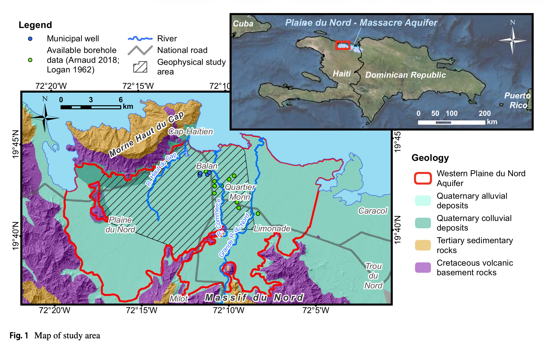
This study by Wm Javan Miner, James K. Adamson, James C. Hasbrouck, Sergio Perez Monforte, and Maria Rodriguez Vera, commissioned by the Government of Haiti and the Inter-American Development Bank, applies gravity and hybrid-source audio-magnetotelluric (HSAMT) geophysical survey methods to the western basin of the Plaine du Nord aquifer near Cap-Haitien, Haiti's second-largest city (population over 170,000, with municipal demand projected to reach roughly 35,338 m3/day by 2035). Because well-drilling records are scarce - prior to this study the deepest known well was only 103 m - these non-invasive methods offered a cost-effective way to map subsurface aquifer thickness and structure without drilling. A team of Haitian geoscientists conducted 75 HSAMT soundings and 50 gravity readings across the study area.
The combined results mapped aquifer thickness exceeding 300 m in the coastal zone and identified zones of increased groundwater potential in the deeper alluvium. A 2021 exploratory well drilled to 200 m in Balan, based on these geophysical findings, confirmed the presence of deeper fresh groundwater beneath the previously characterized shallow zone.
Key Takeaway Cost-efficient geophysical methods like gravity and HSAMT can meaningfully improve understanding of Haiti's alluvial aquifers where drilling records are lacking, and they point to deeper groundwater as a confirmed potential resource to help supply the fast-growing Cap-Haitien area.
Published online 3 June 2022 (Hydrogeology Journal 30:1417-1432); part of the "Advancements in hydrogeological knowledge of Haiti" topical collection
Keep reading this paper by downloading the PDF below.
We Support Safe Water Access
Learn more about how our team brings fresh water to others with technical excellence and integrity.
Learn More